

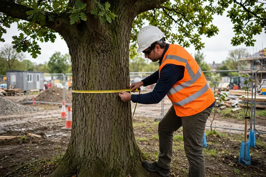
If you are planning a building, an extension or a change of land use where trees are present, a bs5837 tree survey is often the first piece of arboricultural evidence your local planning authority will expect. It records the trees on and next to a site, grades their quality and shows how development can be designed around the trees worth keeping.
This guide explains the survey in plain terms: what the BS 5837 standard is, when a survey is needed, what it records, and how the tree constraints plan, arboricultural impact assessment and arboricultural method statement fit together. It is written for property owners, developers, landlords and design teams working anywhere in the UK.
What Is a BS5837 Tree Survey?
A bs5837 tree survey is a tree survey carried out in line with BS 5837:2012, Trees in relation to design, demolition and construction – Recommendations. That British Standard is the document planning authorities, architects and arboriculturists use as their common reference when development affects trees. It covers the whole process, from the first survey through design, demolition and construction to protection on site.
The survey itself is not a safety inspection, and it is not a report about tree work alone. Its purpose is to give the design team reliable facts before decisions are made. Species, size, condition and expected lifespan are recorded for each tree, and each tree is placed in a retention category. Those facts then shape where buildings, access, parking, drainage and services can sensibly go.
Used well, bs5837 gives everyone the same starting point. The applicant can show that trees have been considered properly, and the planning officer can test the layout against clear evidence.
When Is a BS5837 Tree Survey Required?
A survey is normally required when a planning application affects land where trees are present, either on the site itself or close enough for their roots or canopies to be affected. New housing, a replacement dwelling, a larger extension, a new access or a commercial scheme can all trigger the need, especially where mature trees contribute to the character of the area.
Many local planning authorities will not validate an application until suitable tree information has been supplied. Others will request it during the application once it becomes clear that trees are a material consideration. Either way, commissioning the survey early is far cheaper than redesigning a scheme later. Our guide to planning permission for trees explains the wider consenting picture, including protected trees.
Protection status matters too. A tree may be covered by a Tree Preservation Order or stand in a conservation area, and those controls sit alongside the planning process rather than replacing it. Checking how Tree Preservation Orders work before design work starts helps avoid a layout that depends on removing a tree the council is unlikely to let go.
What a BS5837 Tree Survey Records
On site, the surveyor identifies and plots each tree, or group of trees, that could influence or be influenced by the proposals. Trees are normally given a reference number, and the schedule records a consistent set of information for each one.
- Species, recorded by common and scientific name where identification is certain.
- Dimensions, including height, stem diameter, crown spread and the height of the lowest significant branch.
- Age and life stage, from young and semi-mature through to mature and veteran.
- Condition, covering both physiological health and structural form, with visible defects noted.
- Life expectancy, an estimate of the remaining useful contribution the tree can make, usually in bands of years.
- Preliminary recommendations, such as work needed regardless of development, where relevant.
The most influential part of the schedule is the retention category. Category A trees are of high quality and value, with an estimated remaining life expectancy of at least 40 years. Category B trees are of moderate quality, with at least 20 years. Category C trees are of low quality, with at least 10 years, or young trees with a small stem diameter. Category U trees are in such a condition that they cannot realistically be retained as living trees in the context of the current land use for longer than 10 years. Categories A, B and C are also given a sub-category reflecting whether their value is mainly arboricultural, landscape or cultural, including conservation.
The Tree Constraints Plan
The survey findings are drawn onto a plan known as the tree constraints plan. This shows the plotted position of each tree, its category, its crown spread and, crucially, its root protection area as a shape around the stem. Designers use the tree constraints plan to test layouts before anything is fixed.
Constraints work both below and above ground. Below ground, roots need room to keep the tree alive and stable. Above ground, the existing and future crown needs space, and shading, leaf fall and the simple dominance of a large tree can affect how new rooms and gardens are used. A good tree constraints plan makes those pressures visible early, while moving a building line or a driveway is still straightforward.
Root Protection Areas Explained
The root protection area, usually shortened to RPA, is the minimum area around a tree that the standard says should be left undisturbed if the tree is to be retained. It is treated as the area containing enough roots and rooting volume to keep the tree viable, and it becomes a construction exclusion zone in most cases.
At a high level, the RPA is worked out from the stem diameter. For a single-stemmed tree, the starting point is a radius of 12 times the stem diameter, measured at 1.5 metres above ground level, with the resulting area capped under the standard. Multi-stemmed trees use a combined calculation based on their stems. Where roots are unlikely to grow evenly, for example next to a building, a road or a watercourse, the shape of the root protection area can be adjusted to reflect those conditions while keeping the same overall area.
The practical message is simple. Digging, storing materials, changing ground levels or running vehicles inside a root protection area can all harm a retained tree, sometimes without the damage becoming visible until the tree declines later. That is why the RPA must be known before, not after, a layout is drawn.
The Arboricultural Impact Assessment
Once a layout exists, the next document is the arboricultural impact assessment. This takes the bs5837 survey data and tests the actual proposal against it. Which trees would be removed, and what would their loss mean? Which retained trees would be affected by foundations, access, level changes, drainage runs or service trenches? Would pruning be needed, and would that pruning be acceptable for the tree and for the landscape?
A clear arboricultural impact assessment separates real harm from manageable effects. It identifies conflicts, explains how the design has avoided or reduced them, and states what mitigation or new planting is proposed where loss is unavoidable. Planning officers rely on this document to judge whether the scheme has genuinely been designed around the important trees.
The Arboricultural Method Statement and Tree Protection Plan
Where an impact can be managed rather than avoided, the arboricultural method statement explains exactly how. It sets out the working methods for the site: where protective fencing goes, what ground protection is needed, how excavations near roots will be carried out, where materials and site cabins can be stored, and how the work will be supervised or checked by an arboriculturist.
The method statement is usually read alongside a tree protection plan, which draws those measures onto the final layout. Together, the arboricultural method statement and the tree protection plan turn good intentions into instructions a contractor can follow. Councils commonly secure these documents by planning condition, so they should be written for the people who will actually be on site, not just for the planning file.
The BS5837 Tree Survey Process, Step by Step
Although every site differs, a bs5837 tree survey for a planning application usually follows the same sequence.
- Desktop review. The surveyor checks the proposal, site boundaries, any Tree Preservation Orders or conservation area status, and obtains a suitable topographical survey where one is available.
- Site survey. Each tree is inspected from ground level, measured, photographed where helpful and plotted, and its condition and category are recorded.
- Tree constraints plan. The survey data is drawn up so the design team can work around the root protection area and canopy of each retained tree.
- Design input. The arboriculturist comments on emerging layouts, flagging conflicts and suggesting changes while the design can still move.
- Impact assessment. The final or near-final layout is assessed in an arboricultural impact assessment, including tree losses and mitigation.
- Method statement. An arboricultural method statement and tree protection plan are prepared where protection measures are needed, often to discharge a planning condition.
- Construction support. On larger or sensitive sites, protective measures are checked and key operations are supervised, with records kept for the council.
Who Can Carry Out a BS5837 Tree Survey?
A bs5837 tree survey should be carried out by a competent arboriculturist: someone with recognised arboricultural qualifications, practical experience of trees and development, and a working understanding of the planning system. The report may be scrutinised by a council tree officer, so it needs to be measured, balanced and defensible, not a sales document for the scheme.
Our tree surveyor guide explains what surveyors do more generally and how they differ from tree surgeons, who carry out physical tree work. For a planning submission, ask who will inspect the site, who will write the report, and whether they will stay involved if the council raises questions or imposes conditions.
How Long Does a BS5837 Tree Survey Stay Valid?
BS 5837 does not set a single fixed expiry date for a survey, and it would be misleading to promise one. A survey is a record of the trees as they were on the day they were inspected. Trees grow, decline, suffer storm damage and are sometimes removed, and sites change too. For that reason, a local planning authority may question a survey that is clearly out of date, particularly if an application has been delayed or the site has altered since the visit.
In practice, keep the information current. If a scheme is redesigned, if a long time has passed, or if trees have been damaged or worked on since the original bs5837 tree survey, expect the schedule and plans to need updating, and allow time for a revisit rather than assuming the old report will still be accepted.
Common Mistakes That Delay Planning
Most delays involving trees are avoidable. The problems officers and consultants see most often include the following.
- Commissioning the survey after the layout has been fixed, when the root protection area of a key tree already clashes with a building.
- Using an old or partial survey that misses trees on neighbouring land whose roots or canopies cross the boundary.
- Assuming a low category means a tree can simply be removed, without considering landscape value, protection status or replacement planting.
- Forgetting underground services, drainage and access, which often cause more root damage than the building footprint itself.
- Treating the arboricultural method statement as paperwork, then breaching fencing or storing materials inside a root protection area during construction.
- Failing to check for a Tree Preservation Order or conservation area controls until late in the process.
Getting the Survey Right First Time
A well-timed bs5837 tree survey does more than satisfy a validation checklist. It gives a development a realistic shape from the start, protects the trees that give a site its character, and shows a planning authority that those trees have been taken seriously. Start with the survey, design around the tree constraints plan, test the layout through an arboricultural impact assessment, and protect what is retained with a clear arboricultural method statement. Follow that order, and trees are far less likely to become the reason a planning application stalls.
