

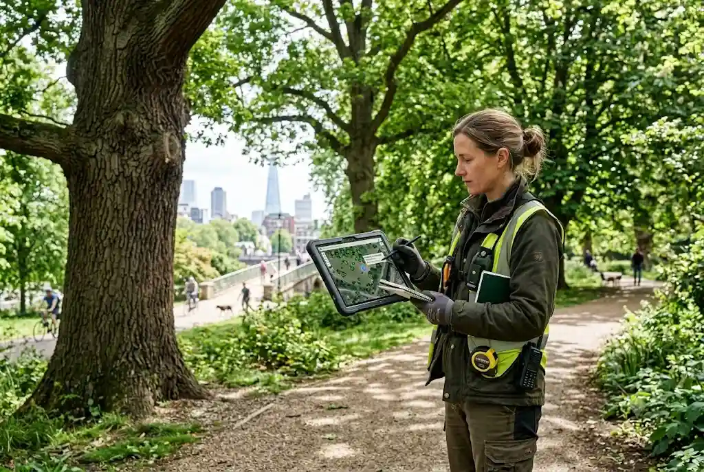
Tree mapping has become an essential tool for arborists, local authorities, landowners, and environmental organisations across the UK. By recording the precise location and condition of individual trees, digital mapping systems help professionals manage tree populations more efficiently while supporting public safety, biodiversity, and long-term environmental planning.
Whether maintaining street trees, monitoring historic estates, or managing large woodland areas, modern tree mapping provides accurate, accessible information that improves decision-making and reduces the reliance on outdated paper records.
What Is Tree Mapping?
Tree mapping is the process of recording the geographic location and characteristics of trees using digital mapping technologies. Each tree is assigned a precise location and linked to important information such as species, dimensions, health condition, inspection history, maintenance records, and risk assessments.
Unlike traditional inventories, digital systems allow information to be updated in real time, making tree management more accurate and efficient.
Why Tree Mapping Matters
Trees provide numerous environmental, economic, and social benefits. They improve air quality, reduce urban heat, support wildlife, store carbon, and enhance public spaces. Managing these valuable assets requires reliable information.
Tree mapping helps organisations:
- Maintain accurate tree inventories
- Plan inspections efficiently
- Track maintenance history
- Monitor tree health
- Prioritise safety inspections
- Support planning applications
- Improve environmental reporting
- Protect valuable tree assets
How Digital Tree Maps Work
A digital tree map combines GPS technology, Geographic Information Systems (GIS), and cloud-based databases to create an interactive record of tree assets.
Each mapped tree can include information such as:
- Species
- Location coordinates
- Height
- Stem diameter
- Canopy spread
- Age category
- Health assessment
- Inspection dates
- Maintenance history
- Photographs
This information is stored digitally, allowing authorised users to update records from the office or directly in the field.
GIS Tree Mapping Supports Better Decisions
GIS tree mapping allows professionals to visualise tree data within interactive geographic maps. Instead of reviewing individual records separately, arborists can analyse entire neighbourhoods, parks, estates, or woodland areas.
GIS supports:
- Risk management
- Maintenance scheduling
- Canopy coverage analysis
- Biodiversity planning
- Development assessments
- Storm damage monitoring
- Infrastructure planning
By viewing tree information spatially, organisations gain valuable insights that support evidence-based decision-making.
Urban Tree Inventory Systems
An urban tree inventory is one of the most common applications of digital tree mapping. Local authorities often manage thousands of street trees, parkland trees, and public open spaces that require regular inspections and maintenance.
A digital inventory enables councils to:
- Locate every recorded tree
- Schedule routine inspections
- Identify high-risk locations
- Track maintenance costs
- Respond more efficiently to public enquiries
- Support environmental reporting
These systems also help demonstrate responsible management and long-term planning.
Tree Mapping Software Features
Modern tree mapping software offers a range of tools that simplify tree management.
Common features include:
- Interactive digital maps
- Cloud-based databases
- GPS integration
- Mobile data collection
- Inspection scheduling
- Photo attachments
- Automated reporting
- Risk assessment modules
- Maintenance tracking
These capabilities reduce administrative work while improving the quality and consistency of tree records.
Interactive Tree Maps Improve Accessibility
Interactive tree maps allow users to explore tree information through web-based platforms. Depending on the organisation, these maps may provide public access to information about local tree species, conservation areas, heritage trees, or community planting projects.
For internal users, interactive mapping supports faster inspections and better collaboration between field teams and office staff.
Combining Tree Mapping with GIS Forestry
Tree mapping becomes even more powerful when integrated with GIS forestry. Geographic Information Systems provide advanced spatial analysis that helps professionals monitor tree populations, identify maintenance priorities, and manage urban forests more effectively.
This integration creates a complete digital management system for individual trees and larger woodland environments.
Using Drone Surveys for Accurate Mapping
Many organisations now combine digital mapping with a drone tree survey. High-resolution aerial imagery collected by drones improves mapping accuracy while reducing field survey time.
Drone data can be imported directly into mapping software to create detailed aerial models and update tree inventories efficiently.
Applications Across the UK
Tree mapping is widely used by:
- Local authorities
- Arboricultural consultants
- Forestry organisations
- Estate managers
- Housing associations
- Universities
- Environmental charities
- Utility companies
Each organisation benefits from improved planning, enhanced safety, and more accurate tree records.
Future Developments in Tree Mapping
Tree mapping technology continues to evolve with advances in artificial intelligence, cloud computing, LiDAR scanning, satellite imagery, and mobile applications. These innovations will improve data accuracy while making digital inventories easier to maintain.
Future systems are also expected to automate species recognition, monitor tree growth, predict maintenance needs, and support climate resilience planning through advanced environmental analysis.
Conclusion
Tree mapping has become a fundamental part of modern arboriculture and urban forest management in the UK. By combining digital mapping, GIS technology, cloud-based inventories, and aerial survey data, organisations can manage tree assets more efficiently while supporting sustainability, biodiversity, and public safety.
As technology continues to advance, tree mapping will remain an essential tool for protecting and managing the UK’s valuable tree populations for generations to come.
For further guidance on sustainable urban forestry and tree management, visit the Forest Research, the UK’s leading organisation for forestry and arboricultural research.
