

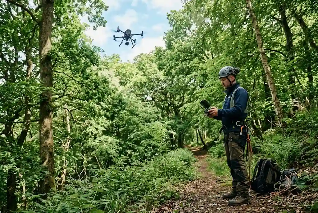
A drone tree survey is transforming the way arborists, local authorities, landowners, and forestry professionals inspect trees across the UK. Traditional tree inspections often require climbing equipment, elevated work platforms, or lengthy ground assessments. Modern drones equipped with high-resolution cameras now allow professionals to assess tree health, identify structural defects, and capture accurate aerial data safely and efficiently.
As drone technology becomes more accessible, it is playing an increasingly important role in arboriculture, woodland management, infrastructure maintenance, and environmental conservation.
What Is a Drone Tree Survey?
A drone tree survey involves using an unmanned aerial vehicle (UAV) fitted with cameras or specialised sensors to inspect trees from above and at multiple angles. The captured imagery helps arborists evaluate tree condition without physically climbing every tree.
Depending on the project, drones may also collect mapping data, generate three-dimensional models, and support detailed vegetation analysis.
Many UK arboricultural consultants now include drone forestry services as part of comprehensive tree assessment programmes.
How Drone Tree Surveys Work
Before the survey begins, the operator plans a safe flight route based on the site conditions, nearby structures, and Civil Aviation Authority (CAA) regulations.
During the inspection, the drone captures:
- High-resolution aerial photographs
- Video footage
- Canopy imagery
- Branch structure
- Crown condition
- Tree height measurements
- GPS location data
The collected information is then analysed to identify defects, maintenance priorities, or potential hazards.
Benefits of Drone Tree Surveys
Using drones offers several practical advantages over conventional inspection methods.
Improved Safety
Inspectors can assess hazardous, unstable, or difficult-to-access trees without climbing, reducing risks for field teams.
Faster Inspections
Large numbers of trees can be surveyed in a fraction of the time required for manual inspections.
Access to Difficult Locations
Drones can safely inspect trees located near rivers, steep slopes, railways, highways, industrial sites, or restricted land.
Detailed Visual Records
High-quality aerial images provide permanent records that can be reviewed later or compared during future inspections.
Cost Efficiency
Reducing the need for specialist access equipment often lowers survey costs while increasing productivity.
Aerial Tree Inspection for Better Decision-Making
An aerial tree inspection provides perspectives that are difficult to obtain from ground level. Inspectors can closely examine upper canopies, deadwood, storm damage, crossing branches, and structural weaknesses.
This information helps arborists determine whether trees require pruning, further investigation, or removal while supporting evidence-based recommendations.
Drone Woodland Survey Applications
A drone woodland survey is particularly valuable for managing larger forested areas where traditional inspections would be time-consuming.
Common woodland applications include:
- Monitoring woodland health
- Identifying storm damage
- Assessing disease outbreaks
- Planning woodland management
- Tracking regeneration projects
- Monitoring invasive vegetation
- Supporting conservation programmes
Drone imagery enables forestry professionals to evaluate woodland conditions more efficiently while reducing time spent on site.
Tree Inspection Drones and Modern Equipment
Today’s tree inspection drones are equipped with advanced technology that improves survey quality.
Features may include:
- 4K or higher-resolution cameras
- GPS positioning
- Obstacle avoidance systems
- Stabilised camera gimbals
- Thermal imaging capabilities
- Automated flight planning
- Long battery life
Some specialist surveys also use LiDAR or multispectral sensors to collect additional environmental data.
Drone Mapping Trees for Digital Management
Beyond visual inspections, professionals increasingly use drones for drone mapping trees. Hundreds of overlapping photographs can be processed into accurate maps and three-dimensional models.
These outputs support:
- Canopy measurement
- Tree inventory updates
- Land management planning
- Site development assessments
- Environmental reporting
- Habitat mapping
When integrated with modern GIS systems, drone mapping provides powerful tools for long-term tree management.
Integrating Drone Surveys with GIS Forestry
Drone imagery becomes even more valuable when combined with GIS forestry. Survey data can be linked directly to mapped tree records, creating accurate digital inventories that include photographs, inspection history, maintenance schedules, and precise locations.
This integration helps local authorities, estates, and consultants make informed decisions while improving asset management.
Supporting Modern Forestry Technology
Drone surveys are just one part of today’s rapidly evolving forestry technology. Combined with cloud software, GPS devices, artificial intelligence, and digital mapping platforms, drones enable more efficient planning, monitoring, and reporting.
These connected technologies continue to reshape how forests and urban trees are managed throughout the UK.
Who Uses Drone Tree Surveys?
Drone surveys are now widely used across multiple sectors.
- Arboricultural consultants
- Local authorities
- Estate managers
- Forestry organisations
- Utilities companies
- Construction consultants
- Environmental agencies
- Property developers
Each sector benefits from improved efficiency, enhanced safety, and more comprehensive visual data.
Regulatory Considerations in the UK
Commercial drone operations in the UK must comply with Civil Aviation Authority (CAA) regulations. Qualified operators are responsible for safe flight planning, risk assessments, airspace compliance, and privacy considerations.
Clients should always verify that survey providers operate legally and maintain appropriate insurance.
Future of Drone Tree Surveys
Drone technology continues to advance rapidly. Artificial intelligence is beginning to assist with automated defect detection, species recognition, canopy analysis, and change monitoring over time.
As battery life, imaging sensors, and mapping software improve, drone tree surveys will become even more accurate and efficient, supporting smarter woodland management and healthier urban forests across the UK.
Conclusion
A drone tree survey offers a safer, faster, and more detailed approach to tree inspections than many traditional methods. From aerial tree inspection and woodland surveys to digital mapping and GIS integration, drones provide valuable information that helps arborists make informed decisions while reducing costs and improving safety.
As technology continues to evolve, drone-based inspections are expected to become an essential part of professional tree management throughout the UK.
For guidance on safe drone operations, visit the UK Civil Aviation Authority, which provides official information on drone regulations and best practices.
