

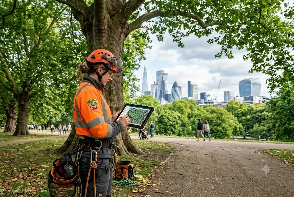
Modern gis forestry is changing how councils, arborists, landowners, and environmental professionals manage trees across the UK. Instead of relying on paper records or isolated spreadsheets, Geographic Information Systems (GIS) provide a central platform for mapping, monitoring, and analysing tree assets. Whether maintaining public parks, managing highways, or protecting woodland habitats, GIS helps organisations make better-informed decisions while improving efficiency and sustainability.
As urban forests continue to grow in importance for climate resilience and biodiversity, digital mapping technologies have become essential tools for long-term planning and responsible tree management.
What Is GIS Forestry?
GIS forestry refers to the use of Geographic Information Systems to collect, store, analyse, and visualise tree and woodland data. Every tree or woodland area can be linked to a precise geographic location along with valuable information such as species, age, dimensions, health condition, maintenance history, and inspection schedules.
This digital approach enables forestry professionals to understand tree populations at both individual and landscape levels while supporting evidence-based decision-making.
Many UK local authorities, consultants, and land managers now rely on geographic information systems forestry solutions to streamline tree management and meet regulatory requirements.
How GIS Supports Urban Forest Management
Managing thousands of urban trees is challenging without accurate location data. An effective urban forest GIS platform provides a complete overview of tree assets across towns and cities.
With GIS, organisations can:
- Locate every recorded tree instantly
- Track inspections and maintenance history
- Identify high-risk locations
- Monitor disease outbreaks
- Plan future planting programmes
- Support biodiversity initiatives
- Improve public safety
- Prioritise maintenance budgets
Instead of reacting to emergencies, managers can proactively maintain healthier urban forests using reliable digital information.
Benefits of GIS Tree Management
Modern gis tree management offers significant advantages over traditional record-keeping systems.
Improved Accuracy
Every tree is mapped using precise GPS coordinates, reducing duplicate records and improving inventory accuracy.
Centralised Information
Inspection reports, photographs, maintenance records, risk assessments, and species information remain connected within one digital system.
Faster Decision-Making
Interactive maps allow arborists and local authorities to identify maintenance priorities quickly without manually reviewing multiple databases.
Better Collaboration
Multiple teams can access the same live information, improving communication between consultants, contractors, planners, and council departments.
Digital Forest Inventory Explained
A digital forest inventory replaces manual spreadsheets with structured geospatial datasets. Each tree receives a digital profile that can be updated throughout its lifecycle.
Typical inventory information includes:
- Species
- Tree height
- Stem diameter
- Canopy spread
- Age category
- Health condition
- Risk rating
- Maintenance history
- Inspection dates
- GPS location
This information provides valuable insight for long-term woodland management and urban planning.
Tree Asset Management Using GIS
Many organisations now treat trees as valuable infrastructure assets. Effective tree asset management ensures trees continue delivering environmental, social, and economic benefits throughout their lifespan.
GIS supports asset management by helping organisations:
- Estimate maintenance costs
- Prioritise high-risk trees
- Schedule inspections efficiently
- Track completed work
- Measure canopy coverage
- Support insurance documentation
- Improve compliance reporting
By viewing trees as long-term assets rather than isolated maintenance tasks, organisations can allocate resources more effectively.
Applications Across the UK
GIS forestry has become valuable across numerous sectors.
Local Authorities
Councils manage extensive tree populations along roads, parks, schools, housing estates, and public spaces. GIS helps maintain accurate records while supporting safety inspections.
Arboricultural Consultants
Consultants use GIS to prepare surveys, produce mapping reports, and deliver visual information for planning applications.
Estate Managers
Large estates can monitor woodland health, schedule maintenance, and improve operational planning through digital mapping.
Utilities
Power companies and infrastructure operators use GIS to identify vegetation risks near overhead lines and critical assets.
Integrating GIS with Modern Forestry Technology
GIS becomes even more powerful when combined with emerging digital tools.
Many organisations now integrate GIS with:
- GPS field devices
- Mobile inspection apps
- LiDAR surveys
- Satellite imagery
- Remote sensing
- Cloud-based databases
- Artificial intelligence
These technologies improve data accuracy while reducing field survey time.
As forestry continues evolving, wider adoption of forestry technology will further enhance digital tree management across the UK.
Future Integration with Drone Surveys
GIS platforms increasingly work alongside aerial data collection. High-resolution imagery captured during a drone tree survey can be integrated directly into GIS software, allowing arborists to inspect difficult-to-access trees while maintaining accurate location records.
This combination improves efficiency for large woodland surveys and extensive urban tree inventories.
Supporting Environmental Planning
Accurate GIS data supports wider environmental objectives beyond routine maintenance.
Tree mapping assists with:
- Climate adaptation planning
- Carbon storage estimation
- Biodiversity conservation
- Flood mitigation projects
- Green infrastructure planning
- Habitat connectivity analysis
These insights help decision-makers balance development with environmental protection.
Choosing the Right GIS Solution
When selecting GIS software, organisations should consider:
- Ease of field data collection
- Cloud accessibility
- Mobile compatibility
- Custom reporting features
- Integration with GPS devices
- Scalability
- Data security
- Technical support
The best solution depends on organisation size, project complexity, and long-term management goals.
Conclusion
GIS forestry has become an essential component of modern urban forest management in the UK. From accurate tree mapping and digital forest inventory to improved tree asset management and smarter maintenance planning, Geographic Information Systems enable organisations to make informed, efficient, and sustainable decisions.
As digital technologies continue advancing, GIS will remain at the centre of smarter arboriculture, helping professionals protect valuable tree populations while improving public safety, biodiversity, and environmental resilience.
For additional guidance on Geographic Information Systems, visit the Esri GIS overview, a widely recognised resource on GIS principles and applications.
